In recent years, there's an unexpected rise in the frequency of the natural disaster. This is where Hazard Mapping, comes to rescue by helping to locate natural hazard along with their physical relationship to people.
Earlier hazard mapping was used to model physical events but with time, its usage has been evolved to map the interaction between the environment and people. Integration of Global Information Systems (GIS) utility mapping in Geelong into the emergency management cycle has drastically helped in enhancing the ability to recover infrastructural components and utilities after a natural disaster.
GIS is a Boon During Emergencies
The usage of GIS is not only limited to locating natural and utility hazards such as seismic faults or flood zones. But they have also been proven to be highly beneficial for emergency managers in making them aware of the situation and helping them visualise and analyse hazardous areas. This also helps in identifying the best spot to place resources before the occurrence of any event.
GIS utility mapping in Geelong uses GIS to analyse the relationship between hazard exposure and social vulnerability. At times of natural disasters, GIS models help decision-makers to suggest response and develop efficient recovery plans.
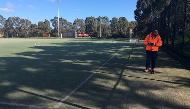
Besides this, emergency managers also need to coordinate with the local organizations to assist with utility location services and evaluate different methods to protect utilities in times of disaster. These organizations have teams who are skilled in GIS utility mapping in Geelong.
What are GIS Models? Everything You Need to Know About
 GIS plays a crucial role in developing a model which helps to implement GIS data in the real-world scenarios.
Usually, the latest technologies are incorporated with the existing system which helps decision-makers to develop an emergency management program based on GIS technology for utility locating and mapping.
Usually, which software will be used in developing GIS models is decided by the experts based on the already available resources. This states the importance of GIS expert without whom implementation of GIS software may not be practical.
Revolution of Mobile Technology in Emergency Management
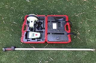
With the rapid advancement in technology and everything going mobile, there's an immense revolution in emergency management as well. Nowadays, GIS utility mapping experts use the latest technology to collect data on their mobile device and upload on cloud servers, to make it accessible from everywhere.
This not only helps in reducing the error rates and data processing time but also helps organisations to fasten utility mapping than compared previous methods. Locating and mapping utility in real-time allows emergency managers to reduce the recovery time of natural disaster.
Importance of Social Data in Disaster Management:
Why do we need social information? Well, information such as ethnicity, age, income, etc. helps identify the population which are prone to risk or their special requirements during the natural hazards. This information is essential for disaster managers to respond quickly to the damage utilities.
Besides this, gathering GIS data from social media allows emergency managers to broadcast disaster information in a top-down manner. Additionally, there's research going on in this field to discover the ways of using social data and use it for improving the awareness of real-time scenarios during emergencies.
What are the Challenges Faced?
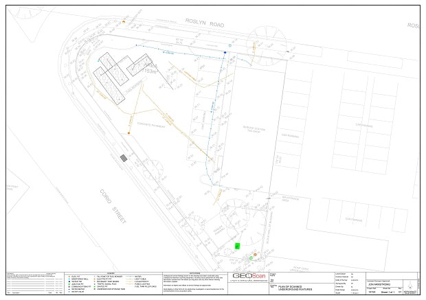
The biggest challenge faced in using GIS data is Cartography. Unfortunately, GIS utility mapping only helps in having the data on a map and it doesn't provide any vital information related to a geospatial relationship which might help emergency managers in managing utilities during the disaster. When viewing a map, disaster/emergency managers need to ask more questions related to the information provided and its significance.
What Experience Do We Have in Disaster Recovery?
Undoubtedly, data collected by GIS can be of immense help in disaster recovery and safeguard underground utilities from future disasters. GeoScan Utility & Structural Investigation has successfully helped in utility location services and GIS utility mapping during natural calamities, allowing the emergency managers to quickly respond and repair the utilities quickly.
Connect with GeoScan Utility & Structural Investigation today to learn more about GIS utility mapping in Geelong for disaster recovery.