In 2020, when the pandemic hit – every industry suffered including the utility location industry. With an increasing need to enable remote work, many underground utility mapping companies drastically invested in the technologies to ensure that all the workers are still protected on the site.
One of the major reasons for adopting technologies for utility engineering was safety. Due to the lower costs and proven usefulness, industry leaders have already predicted the growth in technology adoption. With the pandemic hit, it become more of a necessity allowing companies to keep moving their projects.
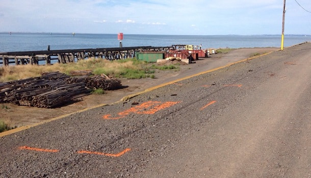
Undoubtedly, utility locating is one of the low-tech industries, but to implement these new tools, it became essential to keep open the job sites while following social distancing norms.
Another major reason for adopting technologies even before pandemic was the growing demand. To keep up with the growing demand for utility locating and mapping services, the contractors need to incorporate the use of technology into their traditional method.
How Technology Adoption is Improving Utility Mapping Services?
In many aspects, the pandemic has fast-tracked the movement of the utility mapping industry to the digital platform. Many tech companies and innovators have shown keen interest in this digital transformation and are liaising with numerous construction and engineering companies to help them work more efficiently and safely.
How Cloud Platforms Helped Increase Collaboration?
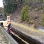
 With the increasing need to implement flexible solutions, many construction and underground utility mapping companies in Geelong have moved their data to the cloud sooner than expected. This helps in not only increasing the safety of the site workers but also helping the entire crew to oversee the entire project without visiting the site.
Ever since the pandemic has begun, the construction companies have shifted towards cloud-based tools which enable them to be productive and work in coordination even while working from home. This arrangement not only gives flexibility but also ensure that all the required information is delivered to the team working on-site instantly and is readily available to be used on any device. These tools enable managers and crew to work together on different aspects of the projects whilst not being together in one place.
How Technology Implementation Helped Improve Speed and Accuracy?
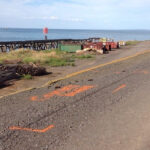
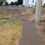
- Laser scanners and the automated optical camera helps collect site data with high accuracy and lower cost.
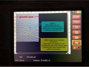
- For underground mapping, cloud-based utility locators with integrated GIS and augmented reality (AR) are used. It helps make information more accessible and readily available.
- With the help of cloud storage, all the tools with GIS and AR act as a digital channel for collecting and transferring all the utility data to work sites.
- This readily available data helps in increasing the safety and efficiency of underground construction by enabling prompt and precise decision making.
How Technology Is Helping Amplify the Labor Force?
 In this ever-evolving construction industry, incorporating the latest technologies helps teamwork efficiently and be more productive. Nowadays, projects are getting complex and moving faster compared to the past. Also, there is an immense shortage in the skilled labour force.
For all the above reasons, the pandemic has accelerated the use of technologies in the construction industry, including drones, robots, security cameras and many more. Working from home and social distancing is here to stay and integrating these technologies facilitate monitoring all the activities on-site remotely.
How Digital Wearables Can Improve Safety?
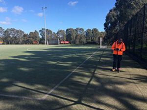
In this pandemic, many companies of underground utility mapping in Geelong have discovered that digital wearable can help track the safety and health of their crew in real-time. These small internet-connected wearables can be attached to work boots, hats or vests which can help with contact tracing and measure social distancing.
These wearables can even help with creating virtual walk-throughs of job sites by linking the device with visualisation and analytics tools.
How Virtual Reality Helps with Better Forecast and Planning?
Even the utility mapping training has been moved online. With the help of AR, virtual scanning devices and simulation applications, the trainers were able to create the entire real-life work-site which helps students understand the actual issues faced and how to troubleshoot those even before those arose.
The Future of Utility Location Services:
With more construction companies and utility locators starting adapting these cloud-based platforms and tols, it will give a clear picture of how utility locating and mapping can be more digitized. All in all, the use of virtual technologies in the utility mapping industry is growing every single day. With its immense benefits, it’s wise to adopt these technologies and create a more efficient and safer work site.